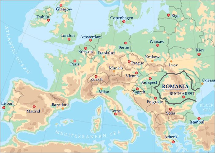
Romania is situated in the southeastern part of Central Europe and shares borders with Hungary to the northwest, Serbia to the southwest, Bulgaria to the south, the Black Sea to the southeast, Ukraine to the east and to the north and the Republic of Moldova to the east. Roughly the size of Oregon, Romania is the second largest country in the area, after Poland.
ROMANIA MAPS
» Romania in Europe
» Romania's physical map
» Romania road map
» Romania rail map
Geographical location of Romania:
between latitudes 43°37’07" and 48°15’06" North and
longitudes 20°15’44"
and 29°41’24" East.
Romania extends approximately 300 miles North to South
and 400 miles East to West.
Bucharest — the capital city of Romania — is located at the same latitude with the cities of Portland - Oregon (USA),
Montreal - Canada, Venice - Italy and Bordeaux - France.
Romania's territory features splendid mountains, beautiful rolling hills, fertile plains and numerous rivers and lakes.
The Carpathian Mountains traverse the centre of the country bordered on both sides by foothills and finally the great plains of the outer rim. Forests cover over one quarter of the country and the fauna is one of the richest in Europe including bears, deer, lynx, chamois and wolves. The legendary Danube River ends its eight-country journey at the Black Sea, after forming one of the largest and most biodiverse wetlands in the world, the Danube Delta.
About a third of the country consists of the Carpathian Mountains (also known as the Transylvanian Alps) rich in wildlife and scenic vistas. Another third are hills and plateaus covered with orchards and vineyards and one third are fertile plains, largely devoted to agriculture.
Country of Romania physical features
Mountains: 31% of Romania's territory
Hills and orchards: 36%
Plains: 33%
Areas covered by rivers and lakes: 3.7%
Total number of lakes: 3,500
Lakes greater than 250 acres: 300
Highest mountain peak: Moldoveanu Mt. — 8,349 ft. (2544 m.)