Romania is home to a variety of landscapes and wildlife as well as to two-thirds of the European Union's primeval forests. Many of Romania’s natural wonders are still wild because they are not easily accessible. The pristine forest, grasslands, subterranean caves, lakes and rivers found in the Carpathian Mountains are true biodiversity oases and sanctuaries where the largest number of big carnivores in the EU thrive. Most big carnivores found in Romania lead a nocturnal life and the vast wilderness of the country offers wildlife, an easy refuge, away from human eyes.
Romania's diverse natural landscapes offer numerous choices for exciting outdoor experiences. Travelers can walk through serene alpine meadows covered with scores of wildflowers, trek around glacial lakes, take in the lush-green scenery while horse riding or mountain biking, climb curious rock formations, photograph fossil traces of 15,000-year old cave-bear species, track gold eagles or other rare birds, study endangered flora, wander in the countryside, picnic in the fields, try your hand at traditional crafts, - or just relax in the home of a village family and sample wholesome, country fare with home-made wine and plum brandy.
Adventurers and wildlife enthusiasts who hear the call of the wild can add these unique experiences to the top of their activities list:
» Spotting wild egrets, Dalmatian pelicans, glossy ibises or some other 300 species of birds in the Danube Delta
» Rock climbing the unusual-shaped rocks Pietrele Doamnei in the Rarau Mountains
» Visiting the Scarisoara ice cave in the Apuseni Nature Park – the 153.6 ft. deep entrance shaft leads to some impressive ice structures, including spectacular six meters high ice stalagmites.
» Exploring the Berca mud volcanoes near Buzau – a stark lunar landscape of erupting mud.
» Taking the Sky Highway challenge — a trek around the Capra glacier lake in the Fagaras Mountains.

» Paddling through the frothy waves of the Crisul Repede and Bistrita rivers.
» Trekking Retezat, the rockiest mountain massif of the country, home to more than 80 glacial lakes and over three hundred flower species.
» Watching wolves at play in the natural park of Vanatori-Neamt in the Stanisoara Mountains, a rich hunting ground during the medieval times.
» Horse riding in the Calimani National Park, renown for its volcanic bizarre shapes, traces of old craters, and the largest volcanic caldera in Carpathians.
» Completing an exciting multi-day hike along the main ridge of the Fagaras Mountains - one of the longest continuous high mountain traverses in Europe, taking you over three of Romania's highest peaks (Moldoveanu - 8,346 ft.; Negoiu - 8,317 ft.; and Vistea Mare - 8,291 ft.).
400 unique species of mammals, including the Carpathian chamois, call the Carpathian Mountains home.
60% of European brown bear population lives in the Carpathian Mountains.
The Carpathian Mountains are forming a semi-circle around Transylvania, which is one of Romania's nine historical provinces.
The Western Carpathian Mountains are also called the Mountains of the Sunset (Muntii Apuseni).
The Carpathian Mountains are home to outstanding natural beauty and offer protection to many rare species of animals and plants. Most of Romania's 14 national parks, 16 nature parks and two geo-parks are located in the Carpathians and also help preserving local customs, traditional crafts, historical settlement patterns, and regional architecture. A network of marked paths and trails and overnight accommodation (lodges or local guesthouses) allow nature lovers to explore one of Europe's most unique wilderness.
Romania's natural areas captured scientific attention as early as the 19th century. The first law on environment protection was passed in 1930; the first forest reservation (Domogled-Baile Herculane) was set up in 1932, the first National Park (Retezat) in 1935 and the first geological reservation (Detunata Goala - Apuseni Mountains) was recognized in 1938.
- Apuseni Nature Park
- Bicazului Gorges - Hășmaș Nat. Park
- Călimani National Park
- Ceahlău National Park
- Piatra Craiului National Park
- Retezat National Park
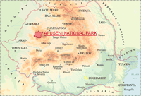
APUSENI MOUNTAINS NATURE PARK
Park Highlights
The Apuseni Nature Park (Parcul Natural Apuseni) - known as the cavers' paradise, protects one of the most interesting cave fauna in Romania. Traces of the prehistoric man, as well as fossils of animals that lived in the Ice Age were found in several of the caves, along with rare bat populations. The higher ridges of the park are covered with spruce fir, while at lower levels the forest is dominated by mountain beech. Limestone underlies most of the park and is responsible for the area's impressive landforms. Sculptured mountain ridges, mysterious underground rivers, and delicate cave decorations will surely keep visitors' photo cameras busy.
The complex karst landforms of Apuseni Nature Park are an attraction on their own, especially hikers with a fascination for geology. Deep valley and gorges, karrens and karst depression – where underground rivers and streams flow - give the landscape an exceptional character. Below ground lies the important and fragile ecosystem of the caves, the main attraction for amateur and professional cavers.
 Note: Apart from the Bears' Cave and Scarisoara Glacier, caving in the Apuseni Nature Park is not visiting nicely prepared tourist caves but visiting them as the first explorers have seen them. That means that you'll have to climb, use ropes, crawl and creep to see their splendid beauty.
As opposed to other national and nature parks in Romania, the Apuseni Mountains are populated up to high altitudes, with permanent and quasi-permanent dwellings. The hamlets on the Ocoale – Scarisoara plateau, at 3840 ft., are among the highest settlements in the country.
If you wish to discover local life and preserved traditions, one of the main points of interest is the Aries Valley, where the beautiful villages of Albac, Garda, and Arieseni are located. Skilled artisans, the Motzi people, carve musical instruments, hope chests and houses from the local wood, the spruce. The Apuseni Motzi villages are some of the best places in which to find tranquility and timeless wisdom of the traditional village way of life. In Patrahaitesti, a little mountain village, you may hear the famous Bucium ("Alps horns"), used for generations in the Apuseni Mountains.
Fast Facts
| Location | Western Carpathians (Alba, Bihor and Cluj counties) |
| Size | 187,000 acres |
| Best known for | Over 200 caves (including the famed Bears' Cave in Chiscau and the Scarisoara Glacier) and the predominant karst formations |
| Natural features | Caves, Deep valleys and gorges, Karst landscapes, Rocky steep walls, Underground watercourses |
| Activities | Caving, Cross-country skiing, Hiking, Mountain biking, Rock climbing, Skiing, Wildlife and bird watching |
Natural Attractions
Scarisoara underground Glacier
Pestera Scarisoara
Location: 4 miles north of village Garda de Sus
Nearby large town: Alba Iulia (52 miles southeast)
Open: Mon. - Sun. 9:00 a.m. - 5 p.m.
Admission charge
Average temperature inside: 32 °F (0 Celsius)
A national monument sheltering the second largest underground glacier on the continent,
the 3,500-year-old ice cave features spectacular icy stalactites and stalagmites.
Bears' Cave
Pestera Ursilor
Location: Chiscau village (1/2 miles south of Pietroasa)
Nearby large town: Oradea (50 miles northwest)
Another natural wonder in the Apuseni Park is the Bears' Cave, named after the skeletons of bears
(extinct 15,000 years ago) discovered here by mine workers in 1975.
Arranged on two levels, it features galleries of animals and castles-resembling stalagmites and stalactites more than a half mile long.
Some of the stalactites are estimated to be 22,000 years old. They continue to grow at a rate of about one-third inch every 20 years.
The upper level (292 miles) is open to visitors, while the second one (312 miles) is reserved for scientific research.
Ponor Fortresses
Cetatile Ponorului
Location: Padis Area (7 miles from Pietroasa commune)
Nearby large town: Beius (22 miles northwest)
Cetatile Ponorului more info
One of the most spectacular and rugged lime formations in Romania, the area known as Cetatile Ponorului
was declared natural reservation in 1952 and soon after became a natural monument. Extending some 21 miles, the area includes the Flowers' Glade (Poiana Florilor) and the Galbenei Gorges (Cheile Galbenei).
Flora and fauna
The cave fauna is the main attraction of the Apuseni Mountains, with some of the caves sheltering rare bat species, such as the dwarf bat (Pipistrellus pipistrellus). Fossils of animals that lived in the Ice Age, as well as traces of the prehistoric man, have been found in some of the caves in the park.
Protected mammals such as the bear (Ursus arctos), the Carpathian elk and the black goat (Rupicapra rupicapra) can be seen in the forest area. The park is also home to several alpine birds, such as the ural owl (Strix uralensis), the nutcracker (Nucifraga caryocatactes) and the lesser spotted eagle (Aquila pomarina).
Attractions not far from Apuseni Nature Park
Turda Gorges Natural Reserve – located just 6 miles outside the town of Turda, the limestone gorges feature peaks, caves, sinkholes and 800 ft. high walls. From here, hiking trails lead to Turen Gorges, Ciucas Waterfalls, and Borzesti Gorges.
City of Cluj Napoca
Cluj Napoca more info
City of Oradea
Oradea more info
Town of Alba Iulia
Alba Iulia more info
Access to Apuseni Mountains Nature Park
Access to the park is possible through the following towns/ villages: Albac, Arieseni, Belis, Chiscau, Garda de Sus, Nucet, Scarisoara, Sighistel
How to get to Apuseni Mountains Natural Park
By air
Nearest airports located in: Cluj, Sibiu and Targu Mures
By car
European road E60: Oradea – Huedin – Gilau - Cluj-Napoca
From Huedin, take county road 761B towards Belis-Fantanele or
Rachitele - Ic Ponor - Padis
From Gilau, take county road 108 to Marisel - Belis-Fantanele
European road E79: Oradea - Beius - Deva
From Sudrigiu take the country road to Pietroasa - Boga - Padis Plateau
or the veer towards Bears' Cave and Craiasa Valley.
National road D75: Turda – Campeni – Albac -Stei
By train
Nearby train stations: Beius, Huedin
To check train schedules for domestic routes please visit RomaniaTourism domestic transportation section.
Accommodations
Accommodation is available in: Lodges (Cabane), B&Bs (Pensiune) and Campgrounds (Poiana Glavoi, Valea Craiesii - near the Bears'Cave, Valea Sighistelului, IC Ponor, Ponor-Runcu Ars).
Visitor info
Apuseni Nature Park Administration
Address: Sudrigiu, Comuna Rieni
Telephone: (+4) 0372 702.242
E-mail
ParcApuseni.ro
Bicaz Gorges - HĂȘMAȘ National Park
Park Highlights
The Bicaz Gorges are famous for their 1000 ft. limestone rocks towering over narrow roads and passes. The road that slices through the Bicaz Gorges (Cheile Bicazului) is among Romania's most stunning and spectacular.
For kayakers and fly-fishing enthusiasts the park's main attraction is the Red Lake (Lacul Rosu), created in 1837 after a major natural landslide. Short and long walks provide access to the lake's spectacular scenery and many fishing spots. The Bicaz Gorges offer a unique view of the Ceahlau Mountains.
Fast Facts
| Location | Eastern Carpathians (Harghita and Neamt counties) |
| Size | 17,000 acres |
| Best known for | The impressive Bicaz Gorges and Lacu Rosu (Red Lake) |
| Natural features | Gorges, Jurassic limestone walls |
| Activities | Fishing, Hiking, Kayaking, Rock climbing, Wildlife and bird watching |
Natural Attractions
Bicazului Gorges - the most spectacular road pass in Romania
The Red Lake (Lacul Rosu) - formed by the natural damming of the waters of the Bicaz stream
Sugaului Gorges
Piatra Singuratica Peak
Flora and Fauna
The alpine wildlife is represented in this area by: the wall lizard (Lacerta muralis) the red deer (Cervus elaphus), the brown bear (Ursus arctos), the lynx (Lynx lynx), the wolf (Canis lupus), the pine marten (Martes martes) and the beech marten (Martes foina).
The wall creeper (Tichodroma muraria), the three-toed woodpecker (Picoides tridactylus), the rock bunting (Emberiza cia), the raven (Crovus corax), the capercaillie (Tetrao urogallus), the oral owl (Strix uralensis), the golden eagle (Aquila chrysaetos), and the great spotted woodpecker (Dendrocops major ) can be seen in the park area as well.
Attractions Near Bicaz Gorges
Neamt county monasteries, near Targu Neamt : Agapia, Neamt, Varatec
Neamt monasteries more info
The Painted Monasteries of Bucovina
Bucovina monasteries more info
Corund pottery centre, known for its nicely decorated ceramics
Town of Suceava
Suceava more info
Park Info
Main access points
Gateways to Cheile Bicazului National ParkThe include villages Balan, Bicaz Chei, Barnadu and Lacul Rosu.
How to get here
Air
Nearest airports to Bicazului Gorges National Park: Iasi and Suceava
Car
National road DN 12C (Miercurea-Ciuc - Suceava) to Bicaz Chei
National road DN 12 (Brasov – Miercurea Ciuc) to Balan
By train
Train
Nearest train stations are Gheorghieni (Harghita county) and Bicaz (Neamt county)
To check the latest train schedules for domestic routes please visit RomaniaTourism
Domestic Transportation section.
Accommodations
Camping areas, Hotels, Tourist pensions
Tourist info
Bicaz Gorges – Hasmas Mountain National Park Administration
Address: Str Principala 664 , Izvorul Muresului
Telephone: (+4) 0266 336.540
E-mail
www.CheileBicazului-Hasmas.ro
CĂLIMANI NATIONAL PARK
Park Highlights
Massive eruptive rocks and craters of old volcanoes in the Calimani National Park (Parcul National Calimani) are spawned over breathtaking landscapes, matched by the presence of large areas of natural ecosystems and the abundance of Swiss stone pine and juniper trees.
The Calimani Mountains features the highest massif in the Romanian volcanic chain, the Pietrosu Peak (standing at 6896 ft.).
The natural erosion process in the volcanic plateau has led to the formation of the unusual shaped 12 Apostles (Cei 12 Apostoli), Red Stones (Pietrele Rosii) and Nefertiti geological reserves.
Fast Facts
| Location | Northern side of Eastern Carpathians (Bistrita – Nasaud, Harghita, Mures and Suceava counties) |
| Size | 64,000 acres |
| Best known for | The volcanic plateau dominated by the Calimani caldera and the abundance of Swiss stone pine and juniper trees that shelter the endangered black grouse (Tetrao tetrix) |
| Natural features | Massive eruptive rocks, Craters of old volcanoes, Swiss stone pine and juniper tree forests |
| Activities | Cross-country skiing, Hiking, Mountain biking, Horseback riding, Skiing, Wildlife and birds watching |
Natural attractions
Iezerul Calimani Natural Reservation preserving the natural elements of vegetation and featuring the beautiful Iezer Lake bordered with dwarf pine and alpine roses
12 Apostles, Red Stone, and Nefertiti geological reserves
Tihu Waterfall – located at the confluence of Tihu and Paraul Umed brooks
Retitis Peak - from the top, there are magnificent views of Ceahlau Mountain and the distant Fagaras Mountains on clear days.
Flora and Fauna
For those interested in botany, Calimani National Park makes it possible to observe 774 species of plants, many of them marked as rare: alpine leek (Allium victorialis), narcissus anemone (Anemone narcissifolia), and mountains soldanella (Soldanella Montana). In juniper tree forests or on soils of volcanic nature, the rose bay (Rhododendron myrtifolium) is frequently encountered.
Calimani National Park is home to several endangered species,such as: the bear (Ursus arctos), the elk (cervus elaphus), the wild boar (sus scrofa), the roe deer (Capreolus capreolus), the wolf (Canis lupus), the tree marten (Martes martes) and the lynx (Lynx lynx). The cedar forest and juniper trees area on the western slope of the Calimani Mountain is home to the black grouse (Tetrao tetrix), a very rare species in Romania.
Attractions Near Calimani Mountains National Park
The Painted Monasteries of Bucovina
Bucovina Monasteries more info
Rodnei Mountains National Park
The wooden architecture, rural life and traditions Maramures villages
The glacier lakes, waterfalls, volcanic mountains, caves and the geological reserve Creasta Cocosului in the Viseu Valley
Park Essentials
Main access points
Gura Haitii, Dorna Candrenilor, Poiana Stampei, Rastolnita, Ilva
How to get to Calimani Mountains National Park
Air
Nearest airports: Cluj, Suceava and Targu Mures.
Car
European road E 85/E 576 to Dorna Candrenilor (Bucuresti - Suceava – Vatra Dornei - Bistrita)
Train
Nearest train stations: Ilva Mica, Lunca Bradului and Vatra Dornei
Train schedules:
To check train schedules for domestic routes please visit RomaniaTourism domestic transportation section.
Accommodation
Camping areas inside the park area, Villages around the park offer tourist facilities, including accommodation.
Tourist info
Calimani National Park Administration
Address: sat Saru Dornei 54 C, Suceava county
Telephone: (+4) 0230 371.104
E-mail
www.Calimani.ro
CEAHLĂU NATIONAL PARK
Park Highlights
Surrounded by watercourses and dam lakes, Ceahlau Mountain, the Olympus of Romania, displays an incredible concentration of flora - over 2,000 flower species, and wildlife. Fossil limestone, the rock formations Dochia, Cusma Dorobantului, and the Duruitoarea waterfall are just some of the main attractions in the park. The park is bounded to the east by the Bistrita River and Lake Bicaz, and to the south by the Bicaz River.
Some of the most exciting Romanian legends refer to the strange stone shapes spread around the peaks in the park. The Dochia rock formations are said to represent a mean old woman ("baba") who came on Ceahlau to feed her sheep. Deceived by the sunny days of early spring, she took off, one by one, all her nine-sheepskin waistcoats. When the frost came, it turned both her and her animals into ice, which over the years transformed into the stones we see now.
Fast Facts
| Location | Northern side of Eastern Carpathians (Neamt county) |
| Size | 19,523 acres / 7,742 ha |
| Best known for | Its legends and significance in the history of the Dacians, the ancestors of the Romanian people. Ceahlau was considered to be the sacred mountain of Zalmoxis, the ancient deity of the Dacians. |
| Natural features | Numerous mountain peaks, Ridges, Basal rocks (limestone and conglomerates placed on crystalline bedrock) |
| Activities | Cross-country skiing, Hiking, Wildlife and birds watching |
Natural attractions
The rock formations Dochia and Cusma Dorobantului
Duruitoarea waterfall (Cascada Duruitoarea)
Ocolasul Plateau, with the Great Ocolasul Peak (6,256 feet) - the highest peak in Ceahlau Mountains – and Toaca Peak (6,246 feet).
Flora and Fauna
Over 90 species of birds can be seen in the Ceahlau National Park. The capercaillie (Tetrao urogalus), the biggest among the birds in the park, can be seen in Piciorul Schiop and Poiana Maicilor, during the mating period in April. With a little luck you can also spot in the same area: the three clawed wod-pecker (Picoides tridactylus) a glacial relict, and the wall creeper (Tichodorma muraria). The raven (Corvus corax) usually builds its nest in the high areas of the mountain.
Among the rare birds nesting in the park are the cliff butterfly (a bird that could be found also in Cheile Sugaului and in Cheile Bicazului), the aquila (Aquila chrysaeltus) and the mountain cock (cocosul de munte).
The park is also home to the black goat (Rupicapra rupicapra), which has been colonized here, the lynx (Lynx lynx), the wolf (Canis lupus), the fox (Canis vulpes), the brown bear (Ursus arctos) and the pine marten (Martes martes). The elk (Cervus elaphus var. carpathicus) - monument of nature and the most valuable species of Ceahlau - can be admired in: Izvorul Alb, Poiana Maicilor, and Izvoarele Bistrei Mari.
Attractions near Ceahlau Mountains National Park
The Painted Monasteries of Bucovina
Bucovina Monasteries more info
Bicaz Gorges - Hasmas National Park
Neamt county monasteries, near Targu Neamt : Agapia, Neamt, Varatec
Neamt monasteries more info
Main access points
Villages Neagra, Tasca, Izvorul Alb, Izvorul Muntelui, Ceahlau village, Grinties village and Durau.
How to get to Ceahlau Mountains National Park
Air
Nearest airports to Ceahlau Mountains National Park:
Car
National road DN15 Piatra Neamt – Toplita
Train
Nearest train station: Bicaz
To check train schedules for domestic routes please visit RomaniaTourism domestic transportation section.
Accommodations
Camping areas (near Cabana Dochia), Mountain chalets (Cabana Izvorul Muntelui; Cabana Fantanele; Cabana Dochia)
Tourist info
Ceahlau National Park Administration
Telephone: (+4) 0233 256.600
E-mail
www.CeahlauPark.ro
PIATRA CRAIULUI NATIONAL PARK
Park Highlights
Piatra Craiului Natural Park features the longest and highest limestone ridge in the country (over 15 miles long and 6560 ft. high). Bordered by glacial lakes, the ridge is regarded as one of the most beautiful sights in the Carpathians. The two-day north–south ridge trail is both challenging and rewarding. Starting at either Plaiul Foii in the northwest or Curmatura in the northeast, hikers climb up to the ridge along the narrow spine of the range. The descent at the southern end leads into a karst landscape of deep gorges and pitted slopes where water penetrating the rock has carved a series of caves.
The traditional villages of Magura, Pestera, Ciocanu, Sirnea, make for interesting starting points for the routes on the eastern slope and for getting in touch with the traditional Romanian way of life.
Fast Facts
| Location | Southern Carpathians (Arges and Brasov counties) |
| Size | 91,000 acres |
| Best known for | The most spectacular ridge in the Carpathian Mountains. The backdrop scenes filmed here for the movie Cold Mountain |
| Natural features | Caves, Meadows, Rocky steep walls, Spruce forests |
| Activities | Caving, Hiking, Horseback riding, Horse carriage / sled strolls, Rock climbing, Wildlife and bird watching |
Natural attractions
Zarnesti Gorges
Dambovicioara Cave
Flora and Fauna
Sheltering one of the largest biodiversity of wildlife in the country, the national park is home to about 300 fungi species, 220 lichen species, 100 different mosses, and 1100 species of superior plants (a third of the number of all plant species found in Romania). On the high cliffs there are chamois, wild boar, red and roe deer, pine martens and red squirrels. Some 270 butterflies species, 110 birds species, 17 bats species, many large carnivores (wolfs, brown bears, lynx) can be observed in the park. The gorges are a good place to see wallcreepers and alpine swifts, three-toed and white-backed woodpeckers and Ural owls in the forested areas.
Nearby Attractions
Brasov Old Town - one of Transylvania' Seven Walled Medieval Towns "Siebenburgen"
Sinca Noua Horse-Riding Centre
Access points to Piatra Craiului National Park
Villages Bran, Cheia, Dambovicioara, Magura, Moeciu, Pestera, Podu Dambovitei, Satic, Sirnea, Zarnesti are gateways to Piatra Craiului Mountains National Park
How to get to Piatra Craiului National Park
Air
Nearest airports:
Brasov,
Bucharest and
Sibiu
Car
Zarnesti, located 18 miles southwest of Brasov and accessible both by road and by railway, is the most important town for access to the northern part of the ridge. From Zarnesti, a 6-mile road makes the connection with Plaiul Foii; a forest road starts from the southwestern part of town, going through Prapastiile, Valea Cheii and Valea Vladasca.
The villages of Magura, Pestera, Ciocanu and Sirnea are starting points for hiking routes on the eastern slope. Podu Dambovitei is the point of approach from the south. From here, the national road DN 73 branches off to the road on Valea Dambovitei through Saticu de Jos and Saticu de Sus, from which several hiking routes lead to the western slope of the Southern Ridge.
Train
Nearest train stations: Brasov and Zarnesti
To check train schedules for domestic routes please visit RomaniaTourism domestic transportation section.
Accommodations
Accommodation available in Camping areas, Mountain chalets and Tourist Pensions.
Tourist pensions in the villages located within the park (Pestera and Magura) and in the surrounding communities (Zarnesti, Moeciu, Sirnea, Ciocanu, Podul Dambovitei, Dambovicioara and Satic)
Tourist info
Piatra Craiului National Park Administration
Tel: (+4) 0268 223.165
E-mail
www.PCrai.ro
Retezat National Park
Park Highlights
Hiking in Retezat National Park you may well lose your breath, not from the climb, but from the breathtaking views of nature at her wildest. Peaks of differing heights, many topping the 8,028 ft. mark (such as Peleaga Peak), provide hikers with plenty of challenges. Travelers willing to tackle them will have their efforts well rewarded.
Local communities and cultural sights from around the park area add a special value to that of the landscape and the biodiversity inside the park. The people in the villages of Salasu de Sus, Rau de Mori and Campu lui Neag preserve to this day the traditional lifestyle of the area.
Fast Facts
| Location | Southern Carpathians (Hunedoara county) |
| Size | 94,000 acres |
| Best known for | - Its more than 80 glacial lakes, including the largest: Bucura (8.8 ha./22 acres),
and the deepest: Zanoaga (29 m/92ft) in the country - The highest number (over 20) of mountain peaks over 2,000m/6,560 ft. in Romania - Being the oldest Romanian national park - established in 1935 |
| Natural features | Alpine and sub-alpine meadows, Deep ravines and ice-scoured parable synclines, Dwarf-pine formations, Glacial lakes |
| Activities | Camping, Cross country skiing, Hiking / walking / trekking, Mountain biking, Rock climbing, Wildlife and bird watching |
Natural attractions
Over one third of the Romanian flora can be found in the Retezat Mountains. High meadows create a haven for rare alpine flora. Long, steep slopes are covered with different types of forest, especially beech, spruce and fir. At the sub-alpine level, slopes shaped by ice are often protected by dwarf pine. The forest line reaches 6,080 ft. with some Spruce adapted to the harsh climate.
More than one quarter of the mountain range is above the 5760 ft. altitude where timberline and glaciers have created terraced valleys that end in magnificent glacial bays, lakes and waterfalls. Extraordinary passes, gorges, cavernous limestone caves and sinkholes can be found on the South-Eastern part of the mountain range, in the limestone area of the Retezatul Mic (the Little Retezat).
Flora and Fauna
Wildlife enthusiasts will find here many species of animals, including chamois, red and roe deer, wild boar, bear, wolf, and fox, and may come across lynx tracks. Otters find themselves at home in the park's rivers. Chaffinch, song thrush, ring ouzel, red-breasted flycatcher, chiffchaff, nutcracker and the rare golden eagle, leaser spotted eagle, eagle owl, pigmy owl, crag martin, scarlet rosefinch, three toed woodpecker, horned lark are among the 120 nesting bird species of Retezat.
Retezat National Park was included in the Important Bird Areas Network. Butterflies are abundant in Retezat, in number and species, and specialists designated two Prime Butterfly Areas here.
Nearby Attractions
The Dacian Fortresses in Orastie Mountains
Town of Alba Iulia
Town of Tragu Jiu
Domogled – Valea Cernei National Park
Main access points
North: Carnic, Rausor, Gura Apei
South: Buta, Cheile Butii, Campusel
How to get to Retezat Mountain National Park
Air
Nearest airports : Sibiu and Timisoara
Bus
Access to Park's Northern entrance: mini-bus from Ohaba de sub Piatră to Carnic (summertime service only)
Access to Southern entrances: mini-bus from Petrosani to Buta and Cheile Butii and from Lupeni to Campu lui Neag.
Car
National road DN66 / E79 (Hateg – Targu Jiu) to Santamarie Orla
and then 686D to Raul Mare
National road DN66 / E79 (Hateg – Targu Jiu) to Petrosani
then DN66A from Vulcan to Campusel
Train
Nearest train stations to the Northern park entrances: Baru, Ohaba de sub Piatra, Pui, Rusor, Subcetate (near Hateg)
Nearest train stations to the Southern park entrances: Petrosani and Lupeni
To check train schedules for domestic routes please visit RomaniaTourism domestic transportation section.
Accommodations
Mountain chalets and B&Bs - can be found in the nearby villages and around the towns.
For more information please visit TurismRetezat.ro
Tourist info
Retezat National Park Administration
Address: Sat Nucșoara 284, Comuna Sălașul de Sus, județul Hunedoara
Telephone: (+4) 0733 888.586
E-mail
www.Retezat.ro