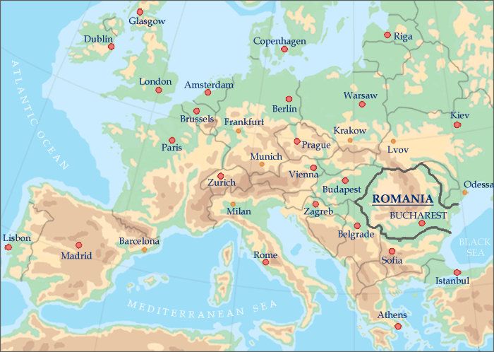
Romania is situated in the southeastern part of Central Europe and shares borders with Hungary to the northwest, Serbia to the southwest, Bulgaria to the south, the Black Sea to the southeast, Ukraine to the east and to the north and the Republic of Moldova to the east. Roughly the size of Oregon, Romania is the second largest country in the area, after Poland.
MAPAS DA ROMÊNIA
» Romênia na Europa
» Mapa físico da Romênia
» Roteiro da Roménia
» Mapa ferroviário da Romênia
Localização geográfica da Roménia:
entre as latitudes 43°37’07" e 48°15’06" Norte e
longitudes 20°15’44"
e 29°41’24" Leste.
A Romênia se estende por aproximadamente 300 milhas de norte a sul
e 400 milhas de leste a oeste.
Bucareste — a capital da Romênia — está localizada na mesma latitude das cidades de Portland - Oregon (EUA),
Montreal - Canadá, Veneza - Itália e Bordeaux - França.
O território da Roménia apresenta montanhas esplêndidas, belas colinas, planícies férteis e numerosos rios e lagos.
As montanhas dos Cárpatos traverse the centre of the country bordered on both sides by foothills and finally the great plains of the outer rim. Forests cover over one quarter of the country and the fauna is one of the richest in Europe including bears, deer, lynx, chamois and wolves. The legendary Rio Danúbio termina sua jornada por oito países no Mar Negro, após formar uma das maiores e mais biodiversas zonas úmidas do mundo, a Delta do Danúbio.
About a third of the country consists of the Carpathian Mountains (also known as the Transylvanian Alps) rich in wildlife and scenic vistas. Another third are hills and plateaus covered with orchards and vineyards and one third are fertile plains, largely devoted to agriculture.
Características físicas do país da Romênia
Montanhas: 31% do território da Roménia
Colinas e pomares: 36%
Planícies: 33%
Áreas cobertas por rios e lagos: 3,7%
Número total de lagos: 3.500
Lagos com mais de 250 acres: 300
Pico da montanha mais alto: Monte Moldoveanu - 8.349 pés (2.544 m)